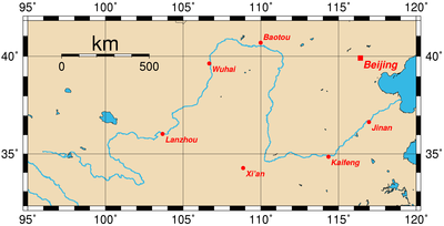
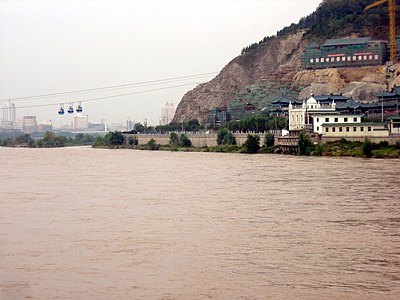
Хуанхэ
Координаталара: Халыып:CountryAbbr 37°46′48″ с. ш. 119°15′00″ в. д. / 37.78000° с. ш. 119.25000° в. д. (G) (O)
Хуанхэ (黄河) - Кытайга Янцзы кэнниттэн иккис уһун өрүс, уонна аан дойдуга алтыс. Өрүс уһуна - 5464 километр, уонна Араҕас байҕалга тиийэр.
| Хуанхэ (黄河) | |
| Араҕас өрүс | |
| River | |
| Country | |
|---|---|
| States | Qinghai, Sichuan, Gansu, Ningxia, Inner Mongolia, Shaanxi, Shanxi, Henan, Shandong |
| Cалаалара | |
| - left | Fen River (and many smaller rivers) |
| - right | Tao River, Wei River (and many smaller rivers) |
| Source | Bayan Har Mountains |
| - location | Yushu Prefecture, Qinghai |
| - elevation | 4800 m (15 748 ft) |
| - coordinates | 34°29′31″ с. ш. 96°20′25″ в. д. / 34.49194° с. ш. 96.34028° в. д. (G) (O) |
| Mouth | Bohai Sea |
| - location | Kenli County, Shandong |
| - elevation | 0 m (0 ft) |
| - coordinates | 37°46′48″ с. ш. 119°15′00″ в. д. / 37.78000° с. ш. 119.25000° в. д. (G) (O) |
| Length | 5464 km (3395 mi) |
| Basin | 752 000 km² (290 349 sq mi) |
| Discharge | |
| - average | 2571 m³/s (90 794 cu ft/s) |


Атын сигэлэр
уларыт- Yellow River delta Information at LSU
- Listen to the Yellow River Ballade from the Yellow River Cantata
- "A Troubled River Mirrors China’s Path to Modernity" New York Times November 19, 2006
- Illustrations of Guarding the Yellow River is an old book that shows how China protected the cities around the River from flooding.
- Illustrated Work on the Storage and Drainage Activities at the Lakes and Rivers of the Yellow River and the Grand Canal
